POSIX
Základní verze skriptu
1 2 3 4 5 6 7 8 9 10 11 12 13 14 15 16 17 18 19 20 21 22 23 24 25 26 27 28 29 30 31 32 33 34 35 36 37 38 39 40 41 42 43 44 45 46 47 48 | #!/bin/sh
# vstup
vis="LC81920252013215LGN00_B4"
nir="LC81920252013215LGN00_B5"
mapset="landsat"
# vysledek
ndvi="ndvi"
# pridat mapset do vyhledavaci cesty
g.mapsets mapset=$mapset ope=add --q
# nastavit vypocetni region
g.region raster=$vis
# vypocet NDVI
echo "VIS: $vis ; NIR: $nir"
r.mapcalc exp="$ndvi = float($nir - $vis) / ($nir + $vis)" --o
# reklasifikace (1,2,3)
echo "Reklasifikuji..."
# r.reclass umi reklasifikovat pouze celociselne rastry, proto pouzime
# r.recode
r.recode input=$ndvi output=r_$ndvi rules=- --o <<EOF
-1:0.05:1
0.05:0.35:2
0.35:1:3
EOF
# popisky
r.category map=r_$ndvi sep=':' rules=- <<EOF
1:bez vegetace, vodni plochy
2:plochy s minimalni vegetaci
3:plochy pokryte vegetaci
EOF
# tabulka barev
r.colors map=r_$ndvi rules=- --q <<EOF
1 red
2 yellow
3 0 136 26
EOF
# vypsat vysledek
echo "Generuji report..."
r.stats -pl input=r_$ndvi
echo "Hotovo!"
|
Skript ke stažení zde.
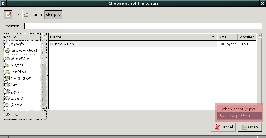
Při spuštění skriptu z GUI je nutno změnit výchozí typ souboru na
.sh.
Pokročilejší verze skriptu
1 2 3 4 5 6 7 8 9 10 11 12 13 14 15 16 17 18 19 20 21 22 23 24 25 26 27 28 29 30 31 32 33 34 35 36 37 38 39 40 41 42 43 44 45 46 47 48 49 50 51 52 53 54 55 56 57 58 59 60 61 62 63 64 65 66 67 68 69 70 71 72 73 74 75 | #!/bin/sh
#%module
#% description: Vypocet reklasifikovaneho NDVI
#%end
#%option G_OPT_M_MAPSET
#% required: yes
#% answer: landsat
#%end
#%option
#% key: output_postfix
#% type: string
#% description: Postfix for output maps
#% answer: ndvi
#%end
#%option G_OPT_F_INPUT
#% key: classes
#% required: no
#%end
if [ "$1" != "@ARGS_PARSED@" ] ; then
exec g.parser "$0" "$@"
fi
mapset=$GIS_OPT_MAPSET
# pridat mapset do vyhledavaci cesty
g.mapsets mapset=$mapset ope=add --q
# vstup
vis=`g.list type=raster mapset=$mapset pattern='*B4$'`
nir=`g.list type=raster mapset=$mapset pattern='*B5$'`
# vysledek
ndvi=$GIS_OPT_OUTPUT_POSTFIX
# nastavit vypocetni region
g.region raster=$vis
# vypocet NDVI
echo "VIS: $vis ; NIR: $nir"
r.mapcalc exp="$ndvi = float($nir - $vis) / ($nir + $vis)" --o
# reklasifikace (1,2,3)
echo "Reklasifikuji..."
# r.reclass umi reklasifikovat pouze celociselne rastry, proto pouzime
# r.recode
if test -z $GIS_OPT_CLASSES ; then
r.recode input=$ndvi output=r_$ndvi rules=- --o <<EOF
-1:0.05:1
0.05:0.35:2
0.35:1:3
EOF
else
r.recode input=$ndvi output=r_$ndvi rules="$GIS_OPT_CLASSES" --o
fi
# popisky
r.category map=r_$ndvi sep=':' rules=- <<EOF
1:bez vegetace, vodni plochy
2:plochy s minimalni vegetaci
3:plochy pokryte vegetaci
EOF
# tabulka barev
r.colors map=r_$ndvi rules=- --q <<EOF
1 red
2 yellow
3 0 136 26
EOF
# vypsat vysledek
echo "Generuji report..."
r.stats -pl input=r_$ndvi
echo "Hotovo!"
|
Výsledná verze skriptu ke stažení zde.